Vous êtes ici : Accueil / Présentation & Historique
Vous êtes ici : Accueil / Présentation & Historique
Mardi 13 juin 1944
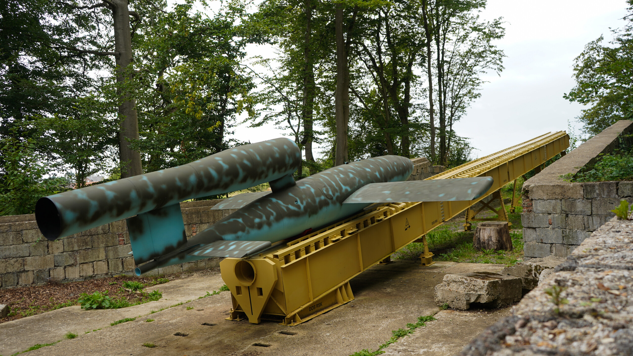
En ce début de printemps retentit en forêt d’Eu une double détonation produite par le V1, l’arme nouvelle que l’Allemagne tente de jeter dans la bataille pour inverser le cours de la guerre qui devient chaque jour plus défavorable.
Et ce n’est pas un hasard si pour la mettre en œuvre, la Luftwaffe, l’armée de l’air Allemande a retenu cette zone entre les vallées de la Bresle et de l’Yères. La profonde forêt d’Eu, la ligne ferroviaire et les nombreux chemins forestiers offraient toutes les conditions favorables pour ce chantier.
La réplique des alliés ne se faisant pas attendre, des milliers de bombes vont s’abattre sur la région causant de dramatiques « dégâts collatéraux » qui ne font que s’ajouter à ceux provoqués par la chute des nombreux V1 défectueux.
Découvrez les vestiges de 19 sites de lancement V1 construits sur notre territoire ainsi que des lieux chargés d’histoire…
Guerville – Poteau de Montauban – Site Nr 161
Campneuseville – Beaulieu – Site Nr 671
Saint-Riquier-en-Rivière – Poteau Maître Jean
Saint-Léger-aux-Bois – Le Mesnil Allard – Site Nr 673
Saint-Léger-aux-Bois – Les Sapins
Rieux – Val de l’eau – Site Nr 163
Richemont – Les Cateliers – Site Nr 183
Richemont – Le transformateur – Site Nr 182
Rétonval – La Ventillette – Site XXX
Rétonval – Le Mont Gournoy – Site Nr 187
Rétonval – Le bout du haut – Site Nr 188
Réalcamp – Les hauts buissons – Site Nr 170
Réalcamp – Les Essartis – Site Nr 169
Réalcamp – Le grand marché – Site Nr 180
Les Landes – Piste 60 – Site Nr 189
Campneuseville – La Houssaye – Site Nr 179
Campneuseville – Bérémont – Site Nr 171
Aumale – Bois de la Vierge – Nr 192
Aubéguimont – Coquereaux – Nr 184

2025 © L’Itinéraire V1 en vallées de la Bresle et de l’Yères | Conception & Réalisation : Le Plus Du Web
